| Aransas Pass, Texas Unofficial Weather | |||
|---|---|---|---|
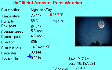
| LAST READING AT TIME: 12:07 PM DATE: June 01 2025, time of next update: 12:17 pm | |||
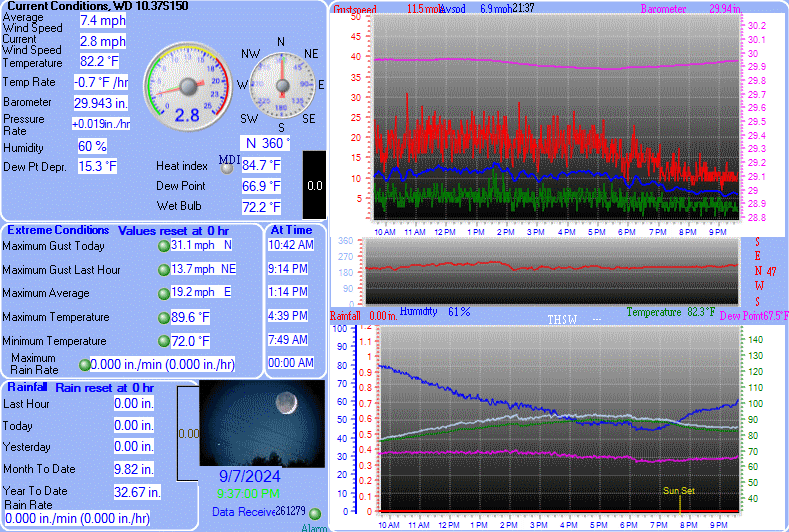
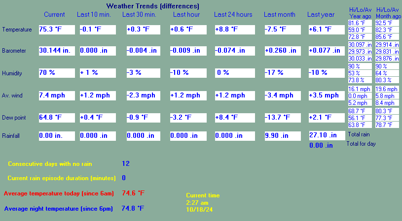
| Current Weather | Dry | Current Temperature | 85.7°F (29.8°C) (Heat Index 97.4°F ), Apparent temp 91.6°F |
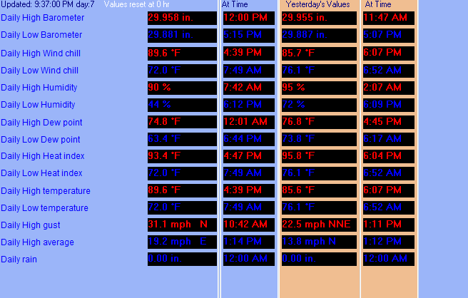
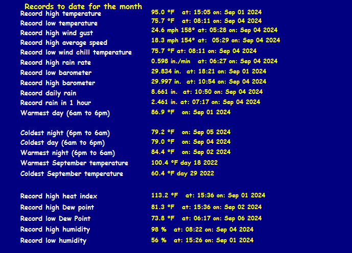
| Maximum Temperature (since midnight) | 86.3°F at: 11:17 AM | Minimum Temperature (since midnight) | 80.3°F at: 3:36 AM |
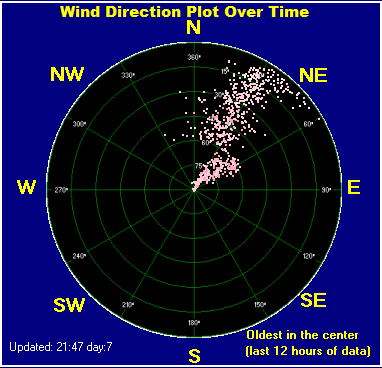
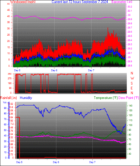
| Average windspeed (ten minute) | 6.1 mph | Wind Direction (ten minute) | S (176°) |
| Heat Index | 97.4°F | Maximum Gust (last hour) | 10.7 mph at: 12:04 PM |
| Maximum Gust (since midnight) | 13.9 mph at: 12:22 AM | Maximum 1 minute average (since midnight) | 9.2 mph at: 12:23 AM |
| Rainfall (last hour) | 0.00 in. (0.0 mm) | Rainfall (since midnight) | 0.00 in. (0.0 mm) --- |
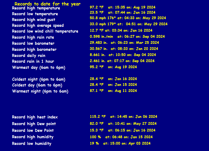
| Rainfall This month | 0.00 in. (0.0 mm) | Rainfall To date this year | 11.58 in. (294.1 mm) |
| Maximum rain per minute (last hour) | 0.00 in/min | Maximum rain per hour (last 6 hours) | 0.00 in/hour |
| Yesterdays rainfall | 0.00 in | DewPoint | 78.0°F (Wet Bulb :80.2°F ) |
| Humidity | 78 %, Humidex 109.1°F | Barometer corrected to msl | 29.961 in. (1014.6 hPa) |
| Pressure change | -0.00 in. (last hour) | Trend (last hour) | STEADY |
| Pressure change (last 12 hours) | -0.00 in | Pressure change (last 6 hours) | +0.04 in |


Use the RELOAD facility on your browser to retrieve the latest data.